Blue Holes
A few posts ago, I wrote about what happens when a river in high water jumps its banks to find a new channel or even form an entirely new delta. But often a flooding river overcomes its levees without changing course. Whether deposited by the river or built up by humans in search of flood protection, levees can fail, unleashing a torrent of water over the landscape in an event traditionally known along the lower Mississippi River as a “crevasse.”[1. The term, like “levee” (from “levée,” meaning “raised”) is testimony to the original French occupation of Louisiana.]
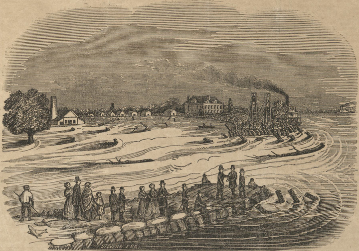
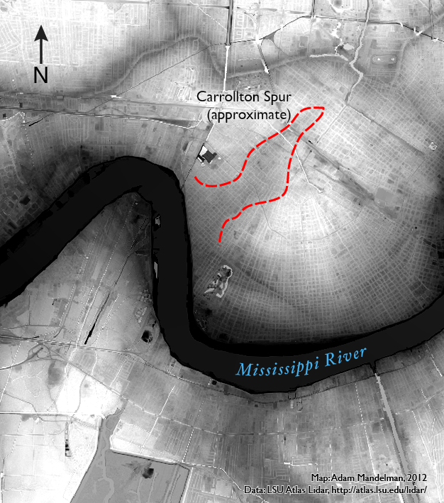
Evidence suggests that some bends in the Mississippi River were even the site of frequent historic crevasses. In uptown New Orleans, for example, a narrow ridge of high ground extends away from the river in a way that’s inconsistent with the area’s natural levees.[2. While avulsions have left remnants of historic natural levees across New Orleans and away from the river—e.g., the Metairie and Gentilly Ridges—the high ground in Carrollton is not part of a historic natural levee either] Known as the Carrollton Spur, the ridge likely formed with repeated crevasses near the Carrolton bend. Each burst of sediment-laden floodwaters through the riverbank built up the land one layer at a time.
This kind of repeated crevassing, however, hasn’t really happened ever since humans have erected and maintained higher, more impermeable levees on the river. Which isn’t to say anthropogenic levees don’t fail, quite the contrary. The infamous breaches along the Industrial, 17th-Street, and London-Avenue canals during and after Hurricane Katrina are among some of the more destructive in recent memory (although, admittedly, those weren’t river levees). Rather, crevasses since European settlement have usually been met with unflagging efforts to repair the breach and prevent further outbursts in the future.
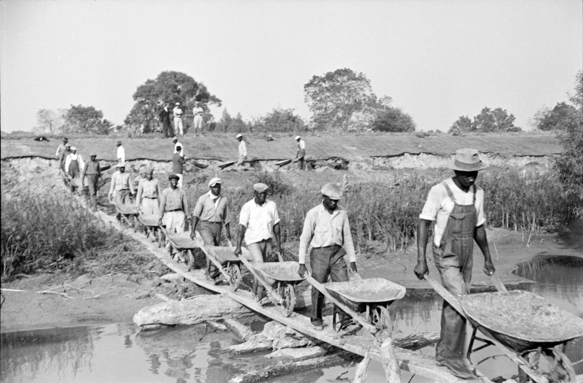
Since crevasses often resulted in loss of life, property, or livelihood and since repairing levees took enormous amounts of labor, they are quite well-represented in the historical record. Looking at historic newspapers, plantation diaries, and official federal, state, and parish (Louisiana’s version of the county) records, one can develop a fairly comprehensive picture of major flood years since European settlement and their associated crevasses.
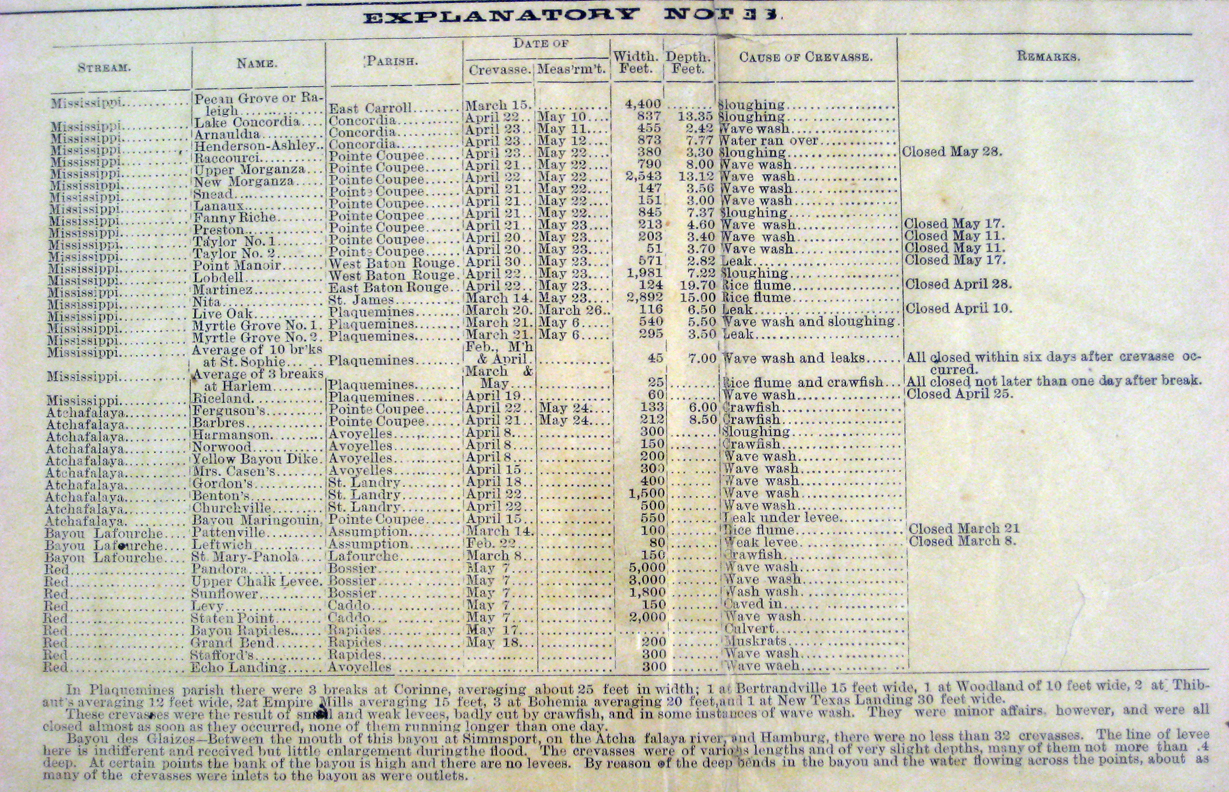
Don Davis, a geographer at Louisiana State University, compiled much of this data for an essay in Craig Colten’s edited volume, Transforming New Orleans and Its Environs. One of the crevasses Davis unearthed for this project was, fittingly, the Davis Crevasse of 1884 (no relation). Named for the Davis railroad station near which it occurred, the breach was described by one observer at the time as:
“…by far the most destructive single crevasse known in the history of Louisiana. Its waters extend in a sea of more than a hundred miles along the west bank of the Mississippi river [sic].”[3. “Territory submerged by the Davis Crevasse,” Daily States, May 22, 1884.]
While that claim about the crevasse’s historical destructiveness is a little dubious (until Hurricane Katrina, Sauvé’s Crevasse of 1849 was generally regarded as the most destructive to affect New Orleans), the breach did, in fact, open a 700-foot wide tear in the levee.
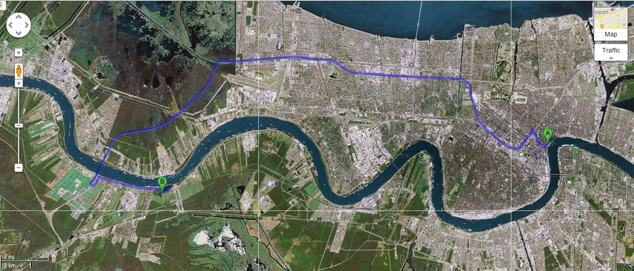
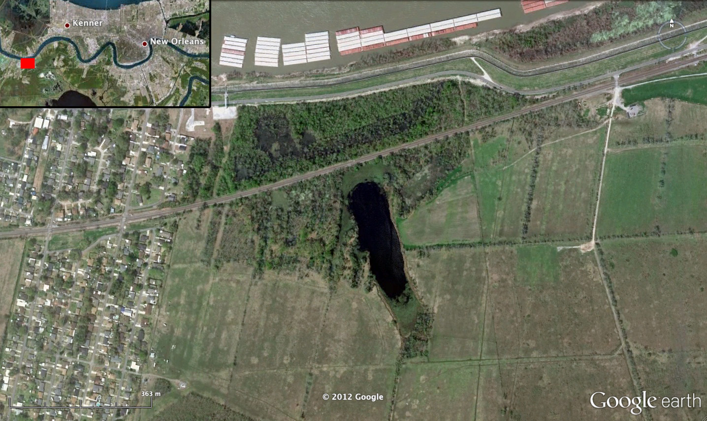
Now, what’s really cool about some of these events is the fact that we don’t just have to rely on historical documents to find evidence of their occurrence. If you take a drive today from downtown New Orleans west out past the airport and get on highway 310, you’ll cross the Mississippi. Make a quick left exit and follow the river back toward New Orleans for about three miles (you’ll pass a massive Monsanto facility when you’re about halfway). Take a right on Levee Road and another quick right at the fork and, after about half a mile, the road will dead end at Davis Pond.
But Davis Pond is no ordinary puddle. It’s actually a “blue hole,” or a water body that forms in a pit scoured out by the surging floodwaters of a massive crevasse. If you were brave enough to take a swim (don’t forget Monsanto’s agro-chem facility up the road) you’d be paddling around in what’s effectively a historical document. This is one of the things I love about environmental history and historical geography: the landscape becomes as much a part of your research method as the archive.
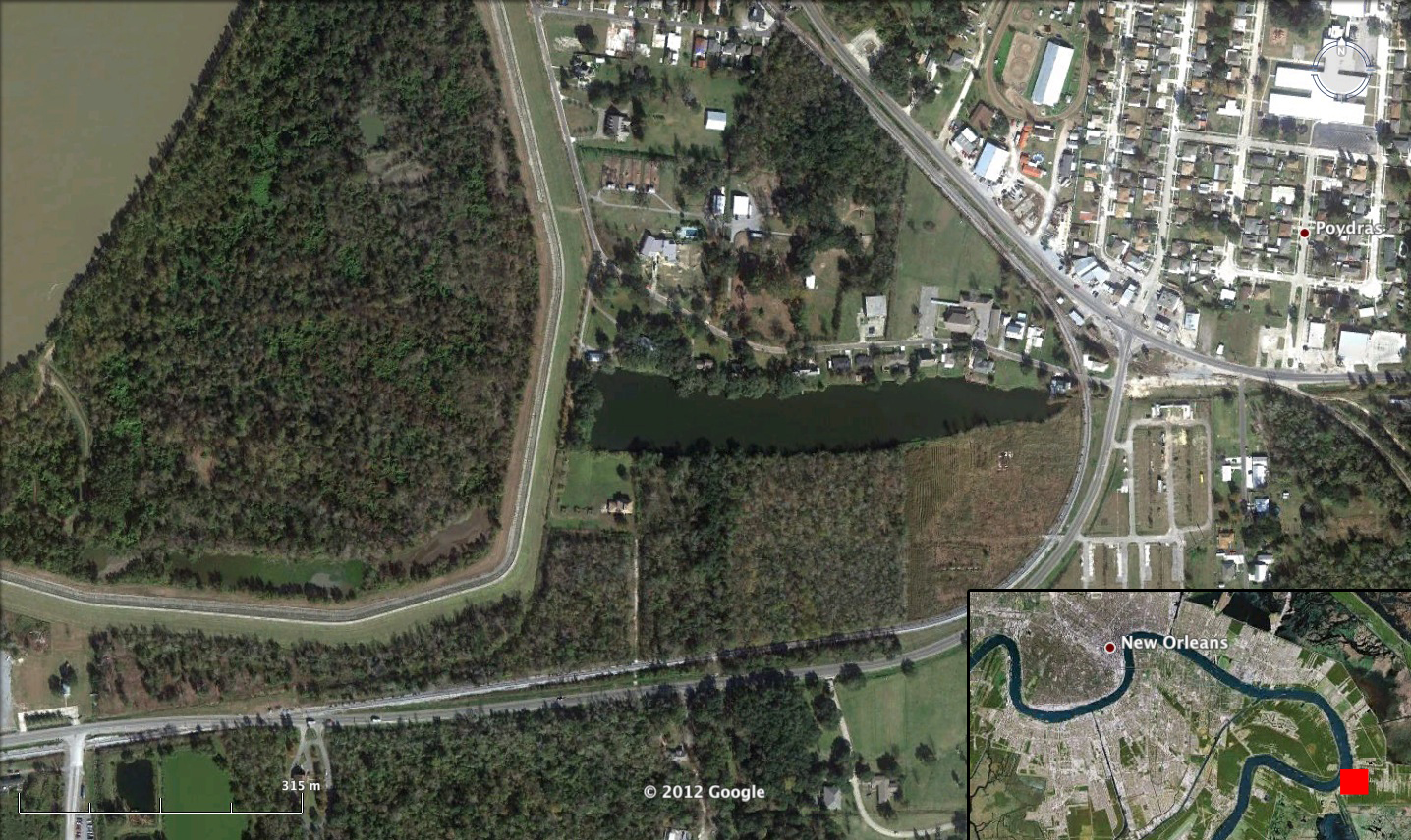
Not every crevasse produces a blue hole, of course, but here and there you’ll find them along the Mississippi. Craig Colten pointed out another one to me just downriver from New Orleans in the town of Poydras. Tapering from the present-day, Army Corps of Engineers levee down to a point near the town’s main intersection, it even more dramatically suggests a crevasse than Davis Pond. Today it’s mainly a residential amenity: about a dozen homes outfitted with small docks line its shores.
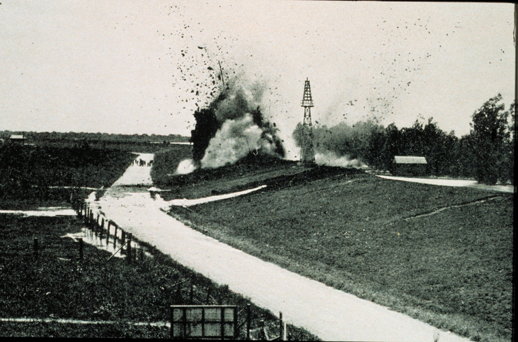
But on April 27th, 1922, a raging flood ripped a 1,500-foot wide hole in the levee, sending a 100-foot high wall of water across the landscape and scouring a 90-foot deep pit from the outskirts of town. Not long after, observers upriver at New Orleans saw that, freed from its confines, the flooding river began to rapidly retreat. Falling two feet in three days, the river spared the city, thanks largely to the destruction it unleashed at Poydras.
When the river once again threatened New Orleans in the disastrous floods of 1927, engineers remembered Poydras and, with the blessing of the city’s political and business leadership, dynamited the levees just a little further downriver at Caernarvon, in St. Bernard Parish. That demolition sacrificed a largely Isleño (Canary Islander) settlement, a population that for some time had been relegated to the social and economic margins of the region.
Though it remains unmarked, the blue hole in Poydras, LA is thus an odd kind of memorial. The intentional crevasse at Caernarvon that it inspired lives on in the social memory of New Orleans. Levee failures during Hurricane Betsy in 1965 inundated three neighborhoods in New Orleans and two in neighboring St. Bernard parish. Largely poor and African-American, residents of these neighborhoods were convinced that the Army Corps of Engineers had again dynamited levees in order to spare people “that mattered.” Those rumors persisted through 2005 when, once again, residents of the Lower Ninth Ward were certain that the city had sacrificed its poorest residents to preserve the fortunes of its wealthiest.
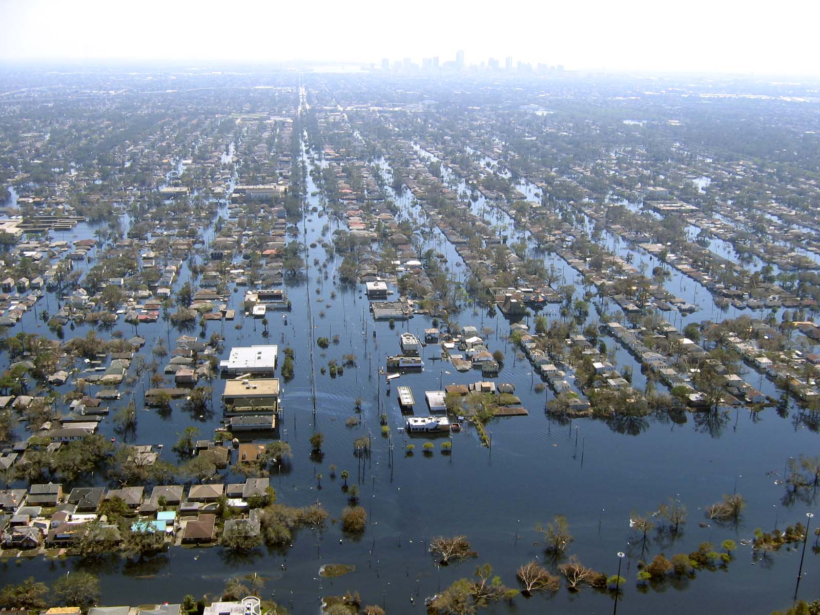
There’s zero evidence that levees were intentionally dynamited during or after Hurricane Katrina. Yet the fact that these kinds of rumors emerged (and persisted) both in 1965 and 2005 speaks volumes about the ways class and race have historically been intertwined with environmental risk in the region. Indeed, the tragedy of Hurricane Katrina was so profoundly shaped by race and class that even without dynamited levees, the disaster exposed deep veins of inequality, neglect, and social discord.
If you know where (and how) to look, southern Louisiana’s landscape is full of unintentional monuments just like Poydras Pond. Whether etched, placed, or otherwise marked on the land, these monuments can serve as revealing guides to environmental histories and memories of social inequality.
Further Reading (and Viewing)
Barry, John. Rising Tide: The Great Mississippi Flood of 1927 and How It Changed America. New York: Simon and Schuster, 1997.
Campanella, Richard. Time and Place in New Orleans: Past Geographies in the Present Day. Gretna, LA: Pelican Publishing, 2002.
Colten, Craig. An Unnatural Metropolis: Wresting New Orleans from Nature. Baton Rouge: Louisiana State University Press, 2006.
Davis, Don. “Historical Perspective on Crevasses, Levees, and the Mississippi River.” In Transforming New Orleans and Its Environs. Edited by Craig Colten. Pittsburgh: University of Pittsburgh Press, 2000, 84-106.
Gomez, Gay. “Perspective, Power, and Priorities: New Orleans and the Mississippi River Flood of 1927.” In Transforming New Orleans and Its Environs. Edited by Craig Colten. Pittsburgh: University of Pittsburgh Press, 2000, 109-20.
When the Levees Broke: A Requiem in Four Acts. DVD. Directed by Spike Lee. Home Box Office, 2006.
Saucier, Roger T. Geomorphology and Quaternary Geologic History of the Lower Mississippi Valley. Vicksburg, MS: US Army Corps of Engineers Waterways Experiment Station, 1994.
Shallat, Todd. “In the Wake of Hurricane Betsy.” In Transforming New Orleans and Its Environs. Edited by Craig Colten. Pittsburgh: University of Pittsburgh Press, 2000, 121-37.

2 Comments
Join the discussion and tell us your opinion.
[…] Two examples from my own work are these hub-and-spoke patterns in Manchac Swamp and this “blue hole” at Davis […]
[…] This exhausting, enthralling week of hanging out with my fellow sediment nerds concluded with a four-stop tour led by Scott Eustis of the Gulf Restoration Network and Public Lab: Gulf Coast. Kicking off at a micro-dredged wetland-restoration site, we soon headed to the Davis Pond Diversion, just downstream from a “blue hole” left by the catastrophic Davis Crevasse of 1884. […]