A Watershed Border Crossing
I recently came across a fascinating old post from landscape-architecture junky Geoff Manaugh over at BLDGBLOG (“building blog”). Manaugh summarizes an event that took place on June 4, 2011 as part of Political Equator 3, a border-crossing, mobile conference that was held simultaneously in San Diego and Tijuana.
The event in question was a participatory, performance-based art project that transformed a culvert into a “pop-up” border crossing. Mexican officials, stationed behind folding tables at the tunnel’s southern end, issued visas to conference-goers as they crossed from the United States into Mexico under the border fence.
Manaugh uses the language of porosity to describe the consequences this ephemeral, obscure port of entry has for the nation-state. He even calls for a history of similarly “peripheral” border crossings—as generated by “espionage, political asylum, wartime defection,… divided cities, and much more”—that blur the borders of sovereignty.
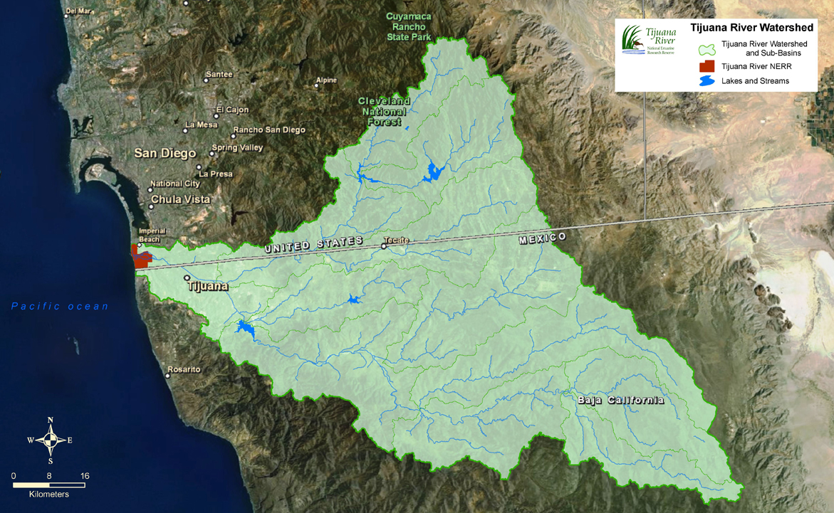
What interested me most, however, was the fact that this border crossing was also meant to highlight the social-ecological consequences of human borders. The culvert-turned-border-crossing allows water to drain unimpeded from Mexico into the United States. Tijuana and San Diego surround the mouth of the Tijuana River, which drains a watershed covering 1,750 square miles, most of which lies in Mexico.

The Tijuana Estuary
Now, lying at the mouth of the Tijuana River, completely within the boundaries of San Diego county (and therefore wholly within the United States) is the Tijuana River Estuary. Designated a National Estuarine Research Reserve under the US Department of Commerce and a “Wetland of International Importance” under the United Nations Ramsar Convention on Wetlands, the reserve contains a national wildlife refuge and is an important rest stop for birds migrating along the Pacific Flyway.
The estuary is a coastal wetland where freshwater from the Tijuana River watershed mixes with the Pacific ocean to produce a fundamentally dynamic salt-marsh ecosystem. Thanks to wave action, tides, and seasonal changes in the river’s flow, the permeable boundaries between fresh, brackish, and salt water constantly shift across the landscape. The river mouth itself, meanwhile, also shifts north and south along the coast as storms, rough seas, and changes in streamflow alter the topography of the estuary.
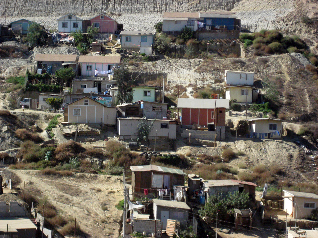
Because the estuary sits at the foot of a watershed, whatever happens upstream, whether in Mexico or the United states, has a dramatic impact on its ecology, regardless of border fences. The culvert traversed by the Political Equator 3 conference ensures drainage within the watershed, but it also illustrates the ways social, economic, and environmental challenges and inequalities upstream transcend political boundaries. Squatter settlements totaling over 85,000 people in Los Laureles canyon on the outskirts of Tijuana—settlements that are themselves emblematic of failures in Mexican social policy—produce erosion and pollution problems that are felt acutely in the estuary (indeed, some of those problems no doubt flow through this very culvert).

No matter how impermeable the border is made in terms of immigrating bodies, the fate of the estuary will always be intimately connected with the fate of marginalized people and communities across the fence. The culvert not only reveals the ways watersheds collapse distance and undermine artificially imposed boundaries, it also highlights some of the ironies and contradictions of those boundaries. What, for instance, would rigidly narrow immigration and border policies look like if they were re-conceived in terms of social and ecological watersheds? What could such a porous set of policies achieve beyond simply preserving ethnic purity jobs and economic resources for American citizens?
You can read more about the Political Equator 3 border crossing (and see some photos from the event) at BLDGBLOG and At the Edges.
And, just in case you want to get a better sense of the place in which this border crossing appeared, I’m almost 100% certain—after close examination of the photos posted at BLDGBLOG and a little topographical research in Google Earth—this is the culvert traversed by Political Equator 3:

2 Comments
Join the discussion and tell us your opinion.
Hi Adam, thanks for the pingback, and I love your site! Yes, indeed, you have identified the right culvert up above–the canyon is known locally as “Goat Canyon” and lies directly across the road from Los Laureles Canyon. The large green areas you see to the north of the culvert are sediment basins built as part of the DHS border infrastructure project. I have a map posted on my feature story, a photograph of the topo map that Teddy Cruz & Oscar Romo created to orient the conference attendees. Teddy pulled this map directly from Google maps, ironically. And speaking of watery landscapes, I just showed my students a short clip from Rivers & Tides…. such a lovely film, and a remarkable engagement with water, space and movement. Thanks again. 🙂
[…] and plant communities, the wettest parts of a wetland can even shift across a given landscape (the Tijuana Estuary’s river mouth, for […]