The Physical Environment 2: High Ground, Low Ground
This is the second in a series of three introductory posts focused on some of the basics of deltaic physical environments. Last time, I looked at what defines a river delta as well as the timing of coastal delta formation globally around 7000-8000 years ago.
Natural levee and backswamp
A key thing to remember about deltaic landscapes is that the rivers running through them are creating, rather than eroding, land. I know I probably sound like a broken record on that front, but it’s also easy to overlook some of its implications. When we think of a typical riparian landscape, I think we often imagine a river valley, in which the highest ground is furthest from the river.
![Thomas Cole - The Oxbow [web] - 1836 Thomas Cole - The Oxbow - 1836](http://adammandelman.net/wp-content/uploads/2012/03/Thomas-Cole-The-Oxbow-web-1836.jpg)

Because of the way rivers deposit sediments in deltas, however, the highest ground is actually closest to the river. During seasonal flooding in these landscapes, sediment-laden water rises above the riverbank. As it spreads over the floodplain, that water suddenly slows, allowing particles of suspended sediment to settle and build on the landscape.
Since the heaviest (and therefore largest) particles settle first, the high ground in river deltas always forms closest to the river. This embankment is called the natural levee. The further one gets from the main channel of the river, the smaller the particles of sediment that accumulate. The relatively narrow strip of high ground that constitutes the natural levee, then, begins to slope back down until it becomes a low wetland known in Louisiana as “backswamp.”
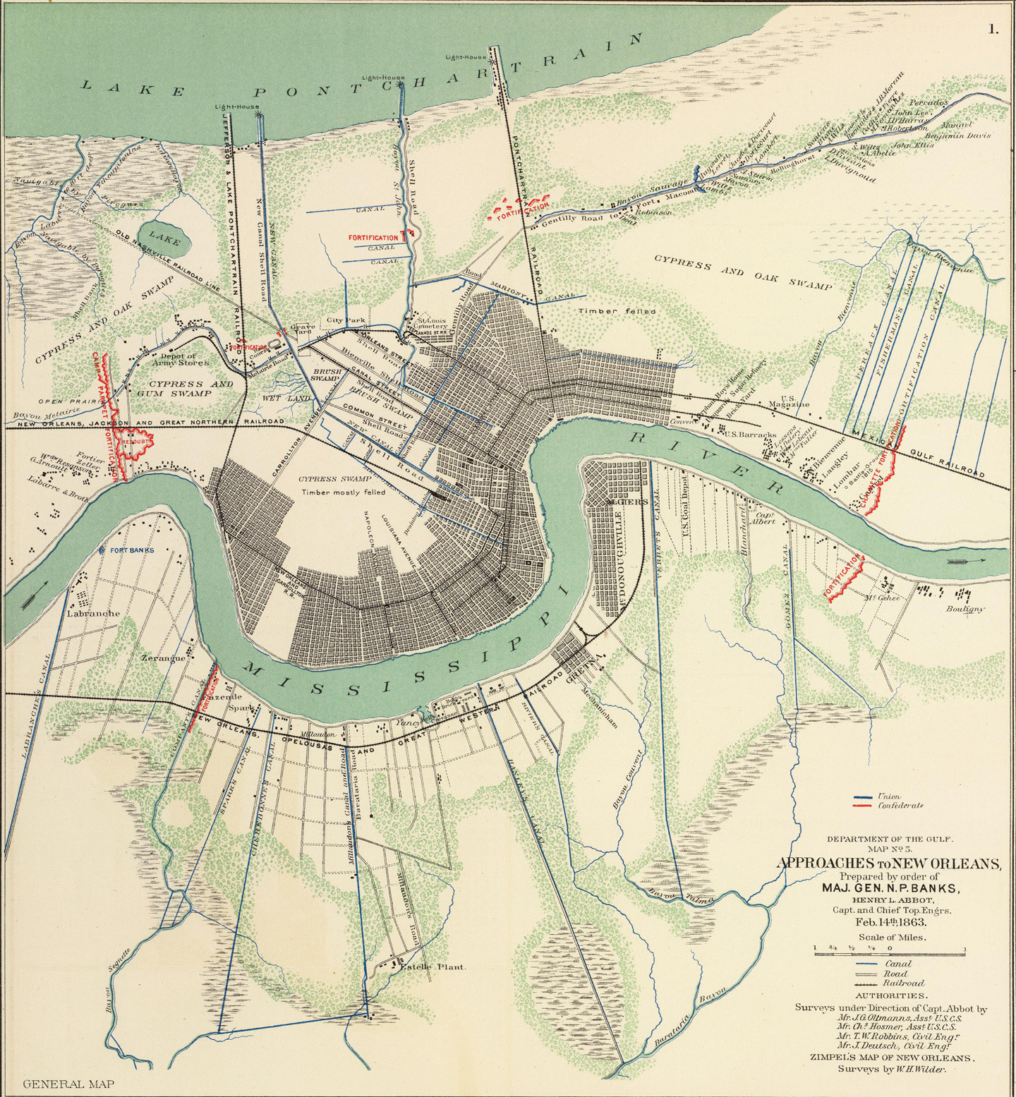
So, while deltas are typically very flat places, what little elevation there is usually hugs the river. That topography is particularly visible in the patterns of historical settlement in the Mississippi River delta.
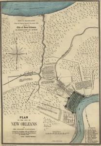
While levees, drainage projects, and other extensive alterations to the landscape have allowed people to build homes and expand urban areas into what was once swampy low ground, places like New Orleans first emerged on the natural levee immediately along the river.

But where does all this sediment come from?
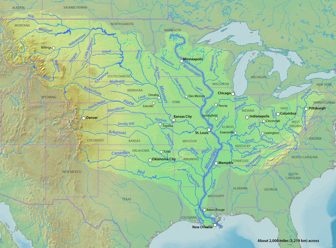
River deltas aren’t building new land and high ground from sediment plucked out of thin air. This material all comes from somewhere. And the way to figure out that “somewhere” is to look at a map of a river’s watershed. In the case of the Mississippi, you’ll notice that its waters are supplied by streams and rivers from as far west as the Rockies and as far east as the Appalachians.

If we think about the distinction between river valleys and river deltas as being one of eroding versus accreting landscapes, we can start to imagine that large river systems are massive sediment redistribution programs. Rain and snowmelt falling higher up in the watershed carry weathered rocks and soils from across the continent down to the mouth of the Mississippi. There, deposited as sediment, these fragments of distant landscapes build the delta. In a way, then, Deltas are the means by which ancient mountains get transformed into new shorelines.
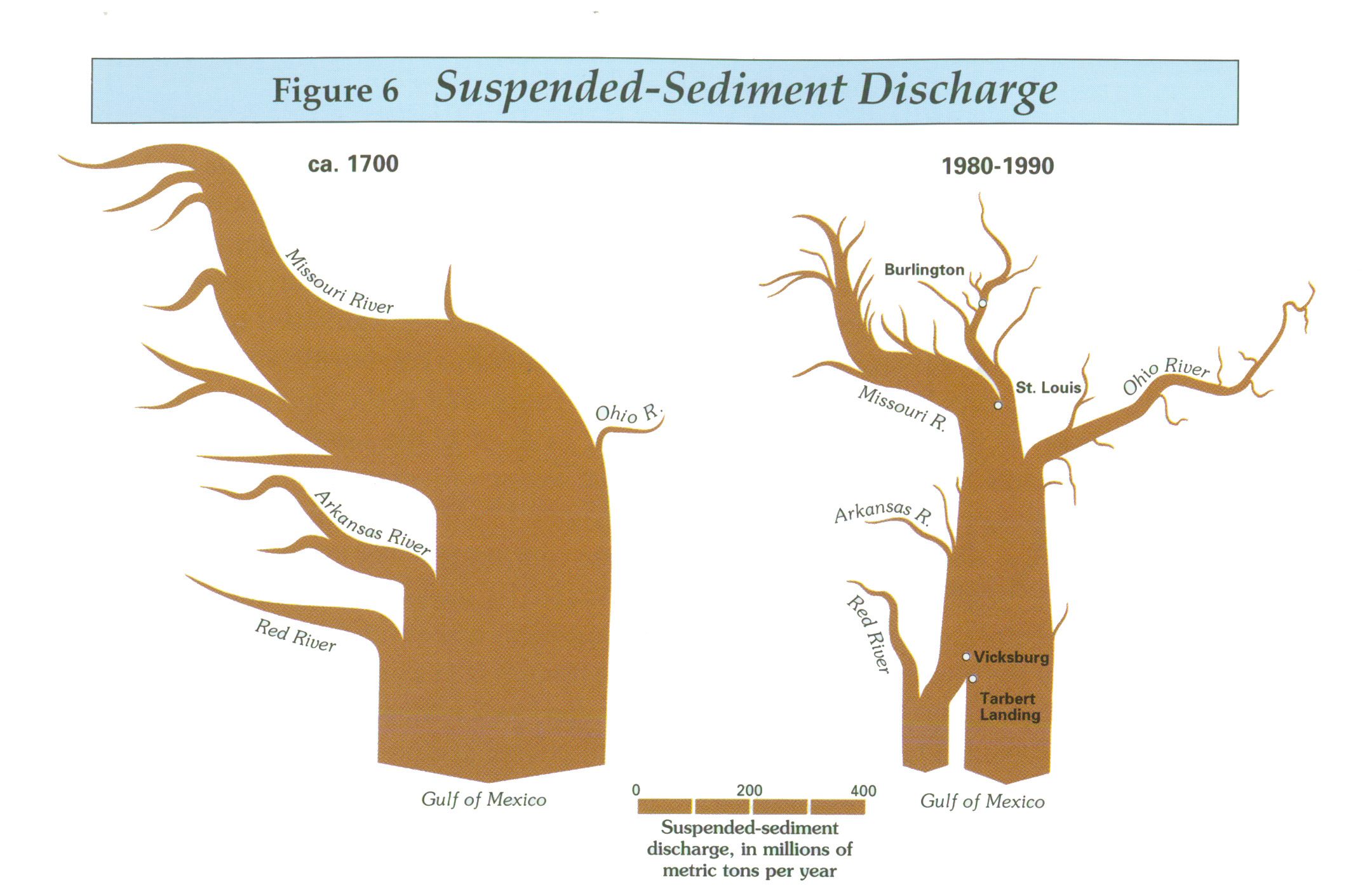
But humans have also radically interfered with that sediment redistribution process in deltas all over the world and the Mississippi River delta is no exception. These days, most sediments are either trapped behind dams throughout the watershed or prevented from spreading over the landscape by the levees lining the river. Land-building in the Mississippi’s deltaic plain has, except in a few locations, practically ceased.

References
Campanella, Richard. Bienville’s Dilemma: A Historical Geography of New Orleans. Lafayette, LA: University of Louisiana at Lafayette, 2008. Also be sure to check out Campanella’s website at http://richcampanella.com/.
Gupta, Avijit (ed.). Large Rivers: Geomorphology and Management. Hoboken, NJ: Wiley, 2008.
Meade, Robert (ed.). Contaminants in the Mississippi River, 1987-92. Reston, VA: US Geological Survey, Circular 1133, 1995.

6 Comments
Join the discussion and tell us your opinion.
I wasn’t sure whether to post my comment here or on your “First Post,” because after reading this I returned to your first post–your blog orientation–for a refresher. There’s a number of striking things here, but one is the elegance with which you handle some pretty complex scientific stuff. I remember trying to write an article that incorporated a pivotal section on the geological history of the Maine coast–and the importance of glacial outwash deltas actually–and feeling like I was in a constant struggle to both sound reputable to a geologist and comprehensible to anybody else. You walk that tightrope quite nicely. I went back to your opening though because I had, over time, lost track of what your blog was trying to do. Your two most recent posts have a level of polish that made me wonder if you were feeding us your dissertation in serialized form! So I was entertained to go back and read the first post, which begins by assuming that no one will ever come back and read the first post. But I quite liked the idea of “porousness,” as you presented it there. I was surprised though that in your bulleted list of types of porousness you would explore that some form of cultural porousness was not among them. Maybe its because I work on Canada and spend too much time around borderlands people, but the idea of customs, practices, languages, and especially ecological knowledge (LEK and TEK) permeating boundaries–be they natural or political–seems to fit nicely into your notion of porousness as you’ve described it. It seems the river has, both as a resource and an adversary, created cultural interactions that this idea would help you to explore. It’s been a while but I’m reminded of John McPhee’s great piece in Control of Nature, called “Atchafalaya.” Anyway, just a thought. Looking forward to the next installment, and I keep meaning to reply to your great comments on my recent posts at SH, but the ideas are still rolling around in my head and defying articulation.
Rob:
Thanks so much for your *very* generous comments. They made my day.
I’m also glad you point out that my recent posts have lent a sort of aimless quality to the blog. For some reason I felt like I had to serve up some background on the physical environment of the place in which I work instead of just launching into weekly thought pieces about watery landscapes. It doesn’t exactly make sense since I imagine very few people read blogs chronologically, let alone start at the beginning (although I appreciate the fact that you went back and read that first post!). And, as you noticed, these posts on the physical environment don’t do much to clarify what I’m doing with the website. In some ways they’re a variation of spinning my wheels, but they’ve also been valuable in keeping me thinking about physical processes and how best to tell stories about them.
In any case, I’m glad they read ok. That means a lot to me. And nope, that stuff definitely isn’t coming from my dissertation, although I imagine I’ll refer back to it all when it finally comes time for me to write the introduction.
Finally, you’re *absolutely* right about cultural exchange/porousness. Porosity/permeability in my project is essentially just an attempt to deploy hybridity perspectives (and I’d include borders and borderlands in that set) in a slightly different fashion. Since I’ve actually been somewhat coy about where I’m going with the whole porosity metaphor, it’s no surprise that hasn’t exactly come through. And while ideas about cultural/social exchange and permeability will definitely be a part of the project and will start appearing in some posts after the next couple weeks, I’m going to continue being coy about them by not going into any details here in the comments 🙂
Thanks again for reading!
This is the third in a series of three introductory posts I’m dedicating to the physical environment of deltaic landscapes. The first post looked at land-building and the timing of delta formation across the globe. The second discussed the quirks of topography in river deltas. Today, I’ll conclude the series by revealing what happens when, as is the case on a deltaic plain, a river occupies the landscape’s high ground.
[…] new delta. But often a flooding river overcomes its levees without changing course. Whether deposited by the river or built up by humans in search of flood protection, levees can fail, unleashing a torrent of water […]
[…] is that? As I’ve discussed previously on this blog (see here, here, and here), coastal Louisiana is a very young, very flat, very muddy landscape. It got built out […]
[…] ← Previous Next → […]